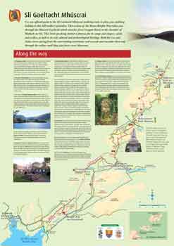
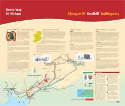
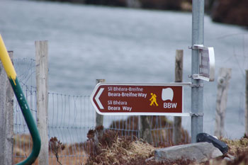
1.ó Chaolchoill go Beal Átha an Ghaorthaidh
Via Guagán Kealkill to Ballingeary via
Gougane Barra.
Walkers for Ballingeary and Gougane Barra should follow the same spur inland as those
headed for Glengarriff. At the first junction Ballingeary-bound walkers take the right
fork as will be indicated. The route travels on a mixture of boreens and off-road tracks so
walkers should be vigilant for signage. This streach includes the steep but short climb
over knockbreteen which rewards with panoramic views of cnoc baoi, Cork’s highest
peak, and Bantry Bay to the west. The route uses quiet roads for 2km before walkers
leave the road to climb between the Shehy peaks of conigar and foilastookeen from
where there are spectacular views of Bantry Bay, the surrounding Shehy peaks and
plains to the east. The decent to Gougane Barra is very steep and the walkers need to
take care with there footing. This walk takes 4-5 hours. The track crosses a 540 metre
high mountain pass. Care needs to be taken on foggy days and avoided in bad weather.
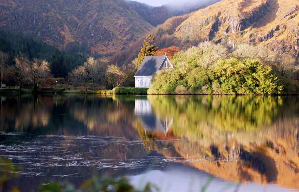
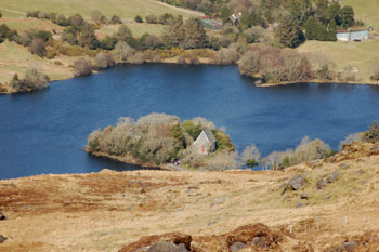
Ó Ghuagán go Béal átha an Ghaorthaid.
Gougane Barra to Ballingeary.
After leaving Gougane Barra walkers cross the river lee close to the clapper stone bridge
following a quite country lane for two kilometres with great views of Ballingeary valley.
The decent into the village takes you past woodland and high farms until you walk the
last mile into the village on a quite public road.
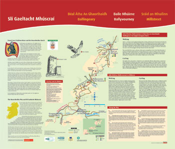
2.ó Bhéal átha an Ghaorthaidh go Baile Mhúirne.
Ballingeary to Ballyvourney.
Walkers leave Béal átha an Ghaorthaidh (Ballingeary) village opposite the GAA pitch.
The route follows a combination of quite country roads and tracks, so walkers must pay
attention to the sign post that lead the way. The route crosses the Bunsheelin river (Bún
Shídh Lann) twice to take in a number of sites of particular significance to the
O’Sullivan Beare story.
It then climbs gently out of the valley to follow the untarred ‘Rae’ road over the hill. The
second half of the walk decends gently to Baile Mhúirne (Ballyvourney) along quiet
back roads, passing through the famous religious complex and oak woods of saint
Gobnait’s just outside the village. Walkers must allow between 3 and 4 hours to
complete the route.
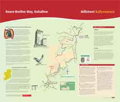
3.ó Bhaile Mhúirne go Sráid á Mhuilinn.
Ballyvourney to Milstreet.
Walkers should allow 6 to 7 hours to complete this long section which involves a steep
climb over the shoulder of Mullaghanish. There are no services between the two
villages and some stretches of the route are quiet lonely. The route leaves Baile Mhúirne
just off the N22. it follows a tarred road for a short distance before climbing through
pasture and open moor land, then enters coniferous forestry. The route affords
magnificent views of village, its oak woods, the derrynasaggart mountain range and a
famed paps of dana. Crossing the road the rood the route enters a coilte forest and
follows forestry tracks for several kilometres, crossing the county boundary into kerry
and back to cork again! Tracks give way to open space, and the route winds its way
below windmills overlooking the plains of north cork. Walkers decend on mountain
track before moving off-road again to pass around Claragh mountain. The last kilometre
of the route follows a public road, where caution should be exercised and ends in
Millstreet.
|